
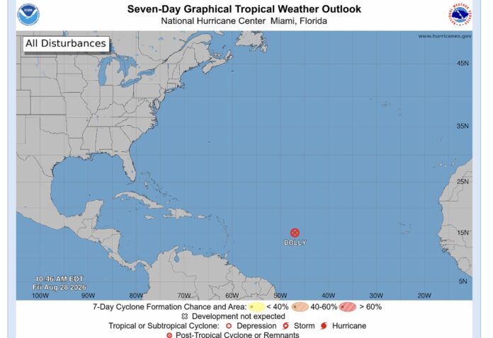

Tropical Storm Dolly has lost its tropical cyclone structure and degenerated into an open tropical wave, but forecasters warn its remnants could still bring heavy rainfall and flash flooding to parts of the Leeward Islands this weekend.
The National Hurricane Center said at 11 a.m. Friday that Dolly’s remnants were about 1,000 miles east of the Leeward Islands, moving west at 25 mph.
The system still had maximum sustained winds near 40 mph, although those winds are expected to fall below tropical-storm strength on Saturday.
On its current track, the remnants are expected to approach the Leeward Islands Saturday night into Sunday.
Heavy rainfall could affect the islands during that period, with the NHC warning that the rain may produce flash flooding, particularly in areas of higher terrain.
The rainfall is then expected to spread toward the Virgin Islands, Puerto Rico and Hispaniola Sunday and Monday.
There are currently no coastal watches or warnings in effect, but residents across the Leeward Islands are being urged to continue monitoring the system.
The NHC said Friday’s 11 a.m. bulletin would be its final public advisory on Dolly.
This article was originally published by Antigua News Room. Read the original article here: Dolly No Longer a Tropical Storm, Heavy Rain Could Still Hit Leeward Islands.